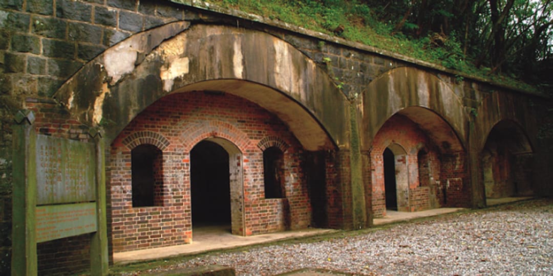
Dawulun Fortification is a very important military base to be the safeguard of the west side of Keelung Harbor. During the Opium War in 1840 and the Sino-French War in 1884, the court of Ching Dynasty sent the military force to guard this place. However, looking at the current structure and feature, the fort was probably renovated during the Japanese colonial period. The provincial historic site was located on Dawulun Mountain. Located 231 meters above sea level, the fortification looks down to Lovers Lake to the west, Dawulun Bay to the north, Keelung and East Sea to the east. Walking up on a pebble footpath full of falling leaves, one will see the original structure of the fortification, chassis, mechanical belt and storage room. Walls were made from stones with arched windows. Since the platform is at the high point facing the ocean, there are lots of scenes to view over northeastern cape from the platform, such as Keelung Islet, Waimushan Seashore, and Badouzih. Dawulun Fortification is located above Lovers Lake. This fort had the important task of defending the west side of Keelung Harbor. It is now a national historic site and the fortification's original structure can still be seen.
※Notice that there is no light at night
Dawulun Fortification
Attractions Map
Position
No.19, Ln. 208, Jijin 1st Rd., Anle Dist., Keelung City 204, Taiwan (R.O.C.)
Parking lot
Two car parks of upper and lower, which can park 50 vehicles; sightseeing buses can park at upper car park.
Time
Unlimited
Ticket
Free
Journey
Take Keelung bus 505 to Qingrenhu Rd. bus stop; follow Lane 208 of Jijin 1st Rd.; it's about 40 min. by foot. Take Keelung bus 509 to Lovers Lake bus stop; walk across the street to the park area.


